Synopsis
Issued at 4:00 AM, 28 April 2025
SYNOPSIS: At 3:00 AM today, a Low Pressure Area (LPA) was estimated based on all available data at 695 km East of General Santos City (5.0°N, 131.3°E). It is embedded along the Intertropical Convergence Zone (ITCZ) affecting Mindanao. Easterlies affecting the rest of the country.
Forecast Weather Conditions
| Place | Weather Condition | Caused By | Impacts |
|---|---|---|---|
| Davao Region and SOCCSKSARGEN | Cloudy skies with scattered rains and thunderstorms | LPA | Possible flash floods or landslides due to moderate to at times heavy rains |
| The rest of Mindanao and Palawan | Cloudy skies with scattered rains and thunderstorms | ITCZ | Possible flash floods or landslides due to moderate to at times heavy rains |
| Metro Manila and the rest of the country | Partly cloudy to cloudy skies with isolated rainshowers or thunderstorms | Easterlies | Possible flash floods or landslides during severe thunderstorms |
Forecast Wind and Coastal Water Condition
| Place | Speed | Direction | Coastal Water |
|---|---|---|---|
| The whole country | Light to Moderate | East to Northeast | Slight to Moderate / (0.6 to 2.5 meters) |
Temperature and Relative Humidity
EXTREMES FOR THE 24-HOUR PERIOD ENDING AT 8:00 PM YESTERDAY
(Recorded at PAGASA Weather Station, Science Garden, Diliman, Quezon City)
| Max | Min | |||
|---|---|---|---|---|
| Temperature | 34.7 °C | 1:00 PM | 23.1 °C | 6:30 AM |
| Relative Humidity | 80 % | 5:00 AM | 42 % | 1:00 AM |
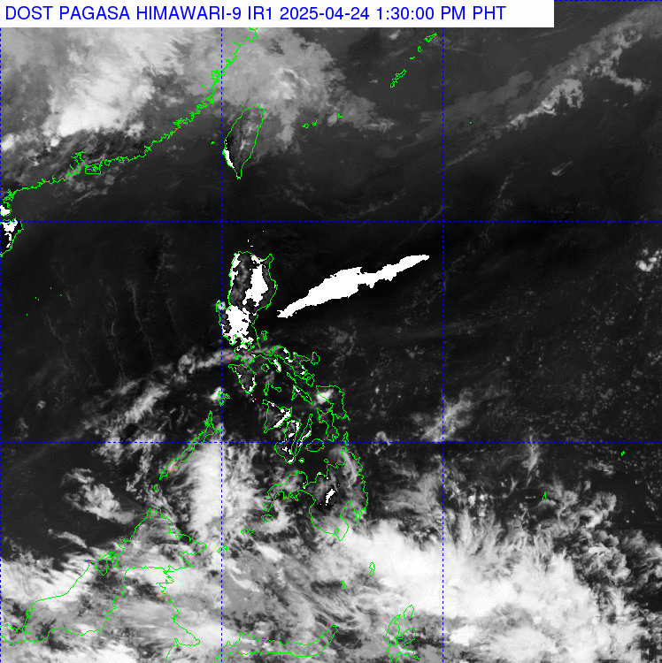
Satellite Image
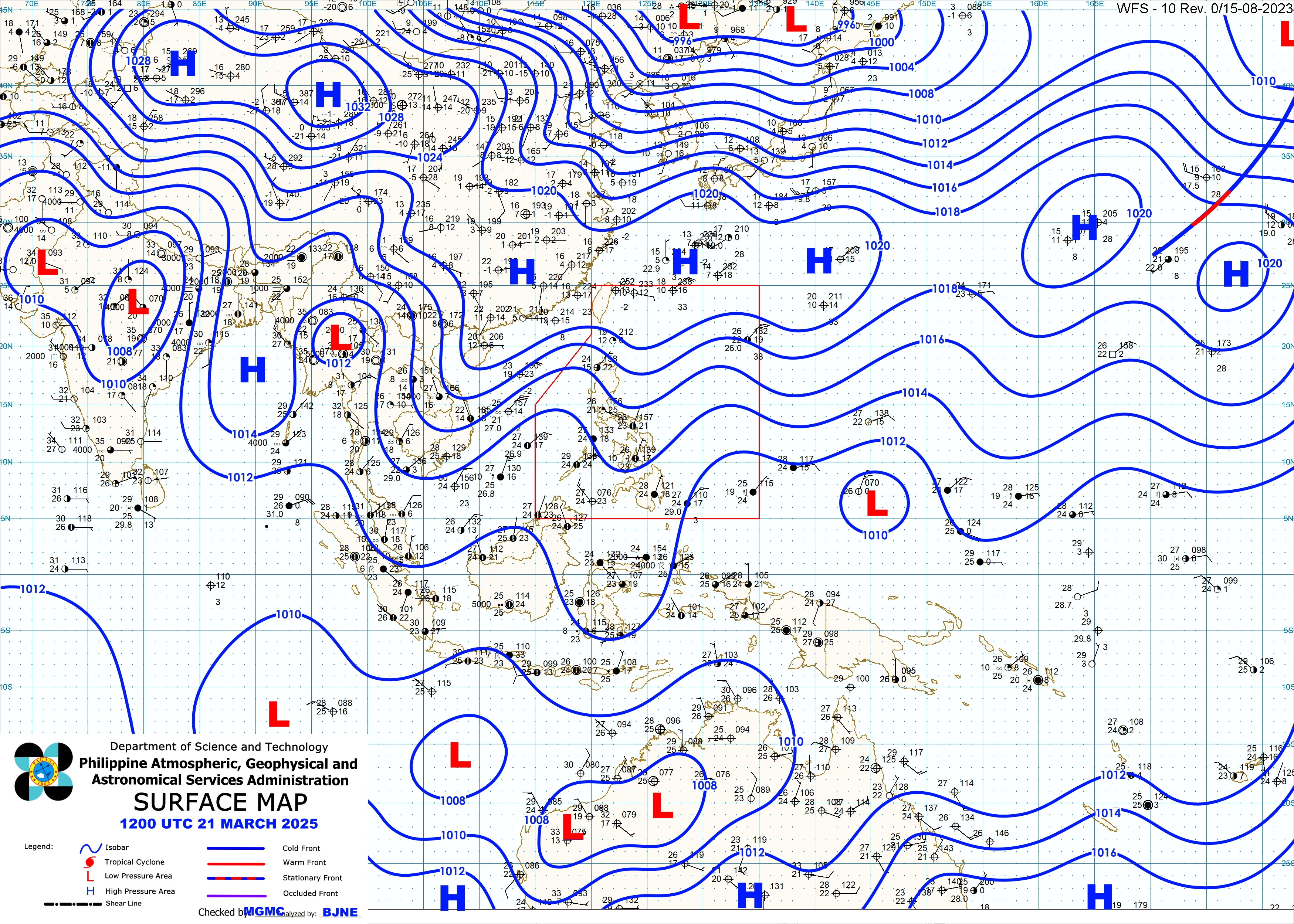
Surface Map Analysis
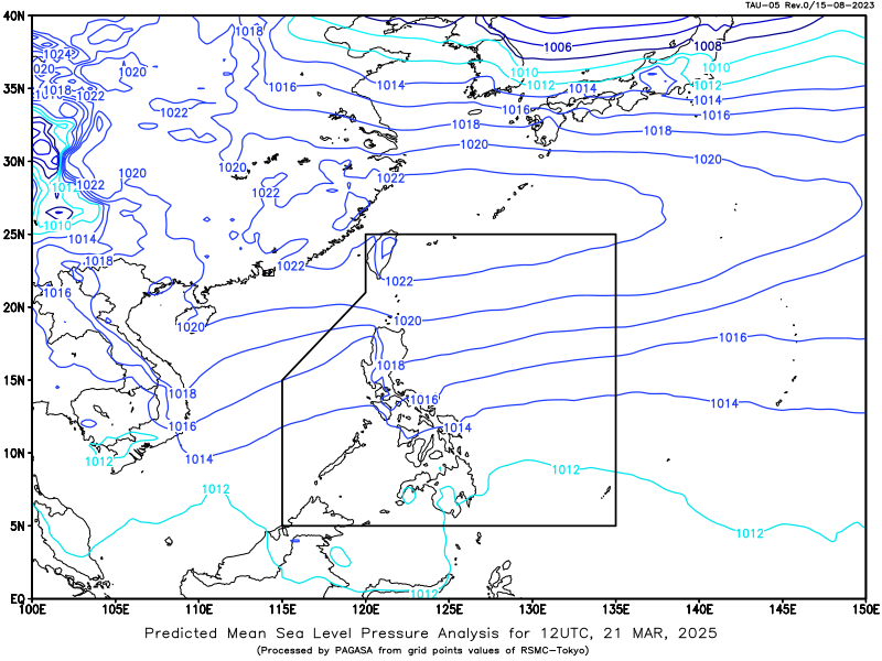
Predicted Mean Sea Level Pressure Analysis 8 :00 AM today,
28 April 2025
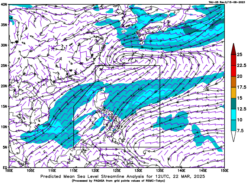
Predicted Mean Sea Level Wind Analysis 8 :00 AM today,
28 April 2025
Tides and Astronomical Information
Over Metro Manila
| Today | Tomorrow | ||||
|---|---|---|---|---|---|
| Astronomy | |||||
| sunrise | 5:35AM | - | |||
| sunset | 6:12PM | ||||
| moonrise | 5:35AM | - | |||
| moonset | 6:47PM | - | |||
| illumination | 1% | - | |||
| Tidal Predictions for Manila Bay (m) (Courtesy of NAMRIA) |
|||||
| Low | 0.34 | 03:17AM | - | - | |
| Low | -0.17 | 05:17PM | - | - | |
| Low | - | - | - | - - | |
| High | 1.04 | 09:56AM | - | - | |
| High | 0.51 | 11:54PM | - | - | |
| High | - | - | - | - | |