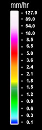
Southern Luzon

Regional Forecast Issued At: 05:00 AM, 10 February, 2025
Cloudy skies with scattered rains and isolated thunderstorms 24° 28°
Wind Speed: Strong to Gale
Direction: Northeast
Coastal Condition: Rough to Very Rough
Cloudy skies with scattered rains and isolated thunderstorms 24° 25°
Wind Speed: Strong to Gale
Direction: Northeast
Coastal Condition: Rough to Very Rough
Extended Weather Outlook Issued at: 09:00 AM, 10 February, 2025
Monday
24° 28°
Wind Speed Strong to Gale
Direction Northeast
Coastal Condition Rough to Very Rough
Tuesday
24° 28°
Wind Speed Moderate to Strong
Direction East
Coastal Condition Moderate to Rough
Wednesday
24° 29°
Wind Speed Moderate to Strong
Direction East
Coastal Condition Moderate to Rough
Thursday
24° 30°
Wind Speed Light to Moderate
Direction East
Coastal Condition Slight to Moderate
Friday
24° 30°
Wind Speed Light to Moderate
Direction East
Coastal Condition Slight to Moderate
Heavy Rainfall Warning No. 3 #SLPRSD
Weather System: Shear Line
Issued at 08:00 AM 10 February 2025

Red Warning: #NorthernSamar and #Sorsogon
Associated Hazard: Serious FLOODING is expected in flood prone areas. Higher chances of LANDSLIDES over the landslide prone areas

Orange Warning: #Albay
Associated Hazard: FLOODING is threatening in low lying areas and near river channels. LANDSLIDES are threatening in landslide prone areas.

Yellow Warning: #Catanduanes and #CamarinesSur
Associated Hazard: FLOODING in low lying areas and near river channels.

Meanwhile, Moderate to occasionally heavy rains affecting #Masbate and #CamarinesNorte which may persist within 2 to 3 hours.

The public and the Disaster Risk Reduction and Management Offices concerned are advised to MONITOR the weather condition and watch for the next warning to be issued at 11:00 AM Today.
As of today, there is no Thunderstorm Advisory Issued.
Active Warnings
General Flood Advisory